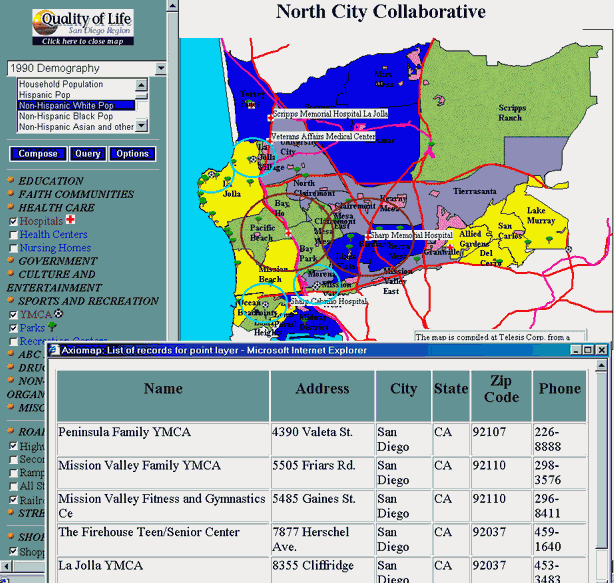
There are two ways to examine characteristics of point symbols in AxioMap .
Displaying an attribute table for point layer objects
Click on the name of the layer in the left frame, and a table with all attributes of layer objects will open in a new browser window. For this, you don't have to render the layer on the map. You can save the table as an HTML file (right-mouse-click on the table, select "View Source", and save the source file), and then import it into Excel or other spreadsheets for editing. Or, you can print out this table (right-mouse-click on the table, and choose Print).
Below is an example of this type of table overlaid on a map.
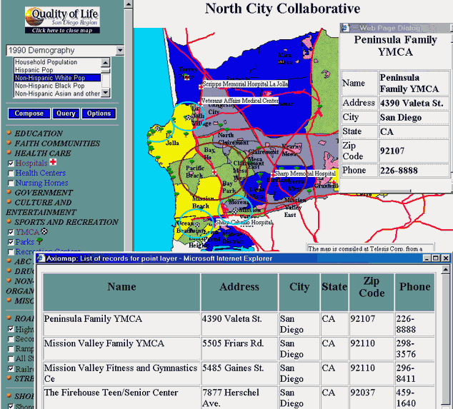
Displaying attribute values for a particular point symbol.
Position your mouse pointer over a point symbol and click the right mouse button. Information about this point will be retrieved from
the database and displayed in a small window. See example below:
Displaying an attribute table for selected area units
Open the Query dialog form, choose "Select All" form the drop-down box, and click "Listing". A table containing all records and variables in the currently selected dataset, will display in a new browser window. If you want to display attributes for selected records only, first select these records using query options (as described in the "Building Queries" page, and click "Listing".