Once a layer is displayed on a map, you can:
- Position the mouse over any point, line or area belonging to this layer, and read an associated label
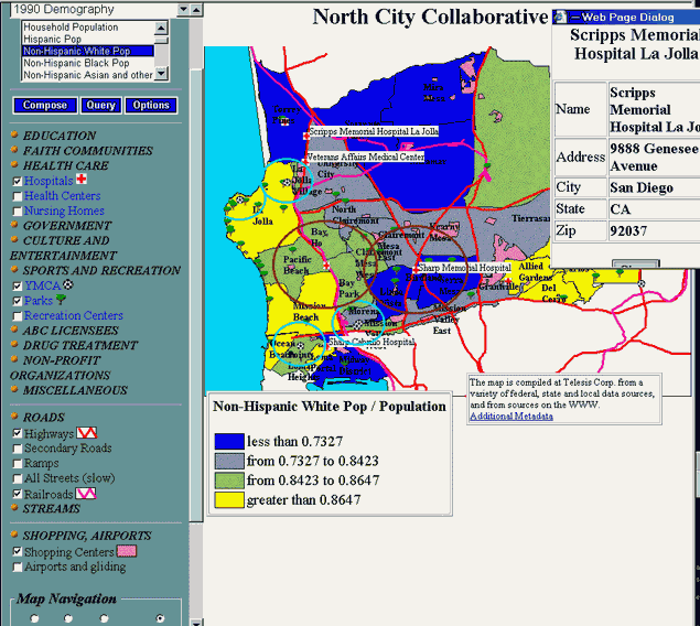
- For point symbols: right-mouse click on a symbol to display attributes of this geographic object
- CTRL-Click on any object to place a label next to it
- ALT-Click anywhere to draw a circle of specified color and radius (set under Options)
- If in the "Open URL" mode, click a point symbol on your map to open a new browser window with the URL (another Web site, or picture, or e-mail form) associated with that symbol. Some symbols have associated URLs, others don't. When you position the mouse pointer over some map symbols, the status bar may display the message "Click to open URL" next to the symbol's name. This means that map designers have attached a URL to this symbol.
Important: if your map retrieves data from several servers
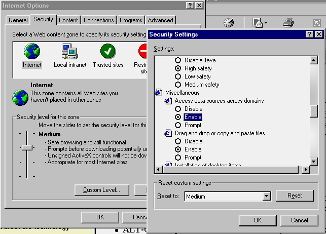
If some layers of your map reside on different servers, you must enable data sharing across domains. From Internet Explorer's menu, select Tools - Internet Options - Security.
Click Custom Level and scroll down to the Miscellaneous group (see picture). Make sure that the Access data sources across domains option is Enabled.
This setting is not necessary if all your map layers are served from one server.